After being tipped off about unsustainable logging at a state-run oil palm plantation, former Rainforest Investigations Network (RIN) fellow Low Choon Chyuan started a year-long investigation during which he uncovered “the failure of the plantation business, the environmental impacts, and how they got multiple loans from a local bank.”
“The investigation exposed the structural weaknesses in Malaysia’s forest management,” Low explained. “Despite various environmental commitments and promises given by the local palm oil industry, this case proved that poor enforcement and monitoring by the government, and the inconsistencies among different ministries in the government, has enabled bad actors to act with impunity.”
In 2015, state-owned company Perbadanan Kemajuan Negeri Pahang (PKNP) started planting oil palms in Hulu Tembeling, Jerantut, Pahang. The site is near Taman Negara National Park, a dense mature forest with rich, but fragile, biodiversity. When Low went on the ground in 2023, he saw how the large-scale project had been mismanaged. It seemed that mainly, the company had just used the project to clear the forest.
In this Pulitzer Center methodology, the reporter Low explained how he prepared for on-the-ground environmental reporting using QGIS and satellite imagery, how he utilized a GPS to follow his own tracks, how to follow the palm oil supply chain, and how he found that the project was funded by a local bank.
Understanding the Project and its Surroundings
Before Low and his team went on the ground, they wanted to know the exact location and size of the PKNP plantation project. They found the project’s boundaries on its environmental impact assessment (EIA) report, which were obtained from a source. By using QGIS, they georeferenced the project from the report. With the location and boundaries mapped, it made it easy to compare it with satellite imagery and see whether deforestation was happening outside the project’s range.
In order to understand the surroundings of the project area, Low searched whether there was any federal zoning such as forest reserve, protected area, environmentally sensitive areas, central forest spine ecological linkage, or water catchment areas. Rimbawatch, an environmental watchdog, published a list of data containing map files of these protected areas, which helped us to understand the surroundings of the area. Low and his team found that the Taman Negara National Park and Al-Sultan Abdullah Royal Tiger Reserves are located very near to the project area.
They visualized the distance between the plantation area and the protected areas. This helped find out whether the sensitive area or protected area would be impacted by the project area and whether they are connected by rivers. It is very powerful visually, to show the proximity of the project and protected areas. In order to analyze and map this data, I used QGIS and Google Earth Pro.

The project area (outlined in yellow) is shown adjacent to a protected area (depicted in orange). Image: Courtesy of Low Choon Chyuan
Satellite Imagery Research
By using the Planet Explorer plugin in QGIS, the team mapped the deforestation that happened within the project area from 2019 to 2023. They chose 2019 because if any oil palm plantation in Malaysia was involved in conversion of natural forest after December 31, 2019, these plantations would not be able to get the Malaysian Sustainable Palm Oil (MSPO) certification. Without it, a company cannot sell its palm oil on the market. Similarly, the EU Deforestation Regulation (EUDR) has its certification deadline for forest conversion on December 31, 2020.

The Planet Explorer plugin in QGIS was used for geospatial analysis. Image: Courtesy of Low Choon Chyuan
The team could have explored the deforestation activities using the Planet Explorer website, but instead chose its plugin inside QGIS because it is more effective and can easily compare satellite imagery from different dates and overlay with the area of the project.
Planet Explorer was a very important tool because it kept the team informed on recent clearing activities in the project area with its weekly updated imagery. Low was given access to regular high-resolution images (three meters) on the platform through RIN and the NICFI Satellite Data Program.
Gathering Data from the Field Trip
After finishing their initial desk research, the team went for a reporting trip to the project area. Low found it very useful to align both information gathered from online research and ground reporting. Sometimes it was very frustrating because the team was in the middle of nowhere, surrounded by only forest and rivers. It is very challenging to geolocate the events and things seen on the maps on computers. The villagers are familiar with the area, but they were unable to point it out on a map.
Wikiloc is a navigation app for hikers, but Low found it very useful for investigation work in the forest or on the ocean. After activating the app, he clicked on “start recording” to record the trails. Even if his phone had no signal or Wi-Fi it would still record the trails. After his reporting trip, Low was able to check his trail on his phone, and export the trail so that he could view it on QGIS, and then compare the project area and satellite imagery research.
Wikiloc has a “waypoint” feature, which allows taking a photo along the trail, and mark the type of waypoint at the location of the photo, such as an intersection. The photos and waypoints are very useful to help reporters recall the significance of these locations. Alternatively, you can allow photo geotagging on your mobile phone, so each photo you have taken will contain geolocation data.

The waypoint feature on the Wikiloc mobile app helps with recording key locations visited during on-the-ground reporting. Image: Courtesy of Low Choon Chyuan
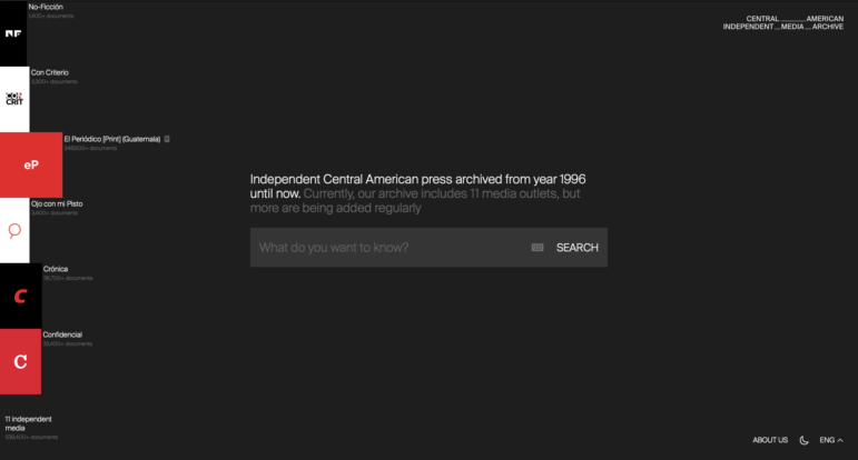
After the reporting trip, Low cross-checked his findings on the ground with satellite imagery. For instance, a villager told him the river he used to fish at lost its aquatic life after the forest was logged. Through high-resolution satellite imagery provided by Airbus through Earth Genome — a Pulitzer Center partner — the team was able to zoom in on this specific river and found that the plantation cleared the riparian area of this river, which is a violation of its own environmental impact assessment and the industry’s requirements.
In 2016, vegetation still covered riverbanks that run through PKNP’s plantations. In 2022, the riverbank became fully exposed due to extensive logging activities. Image: Courtesy of Malaysiakini
Monitoring Forest Changes through GFW
Low also uploaded the project range data to Global Forest Watch (GFW) and enabled notifications for fire alerts and forest changes. That helped keep track of whether the logging is still ongoing, see the frequency, and monitor the area that was cleared. The platform also has an analysis feature, which can calculate the area of tree cover loss in a specific area and time range.
Tracking the Supply Chain
Next, the team wanted to find out where the palm oil went.
To do this, they used the super helpful platform Palmoil.io, which contains plantation locations and plot maps, ownership information, grievances, and risk insights. The website also provides supply chain information of a plantation, for example, which traders or millers have received palm oil fruits from the plantation. However, Low wasn’t able to find much information on the PKNP plantation because the plantation has very low-yield production.
MSPO, the Malaysian certification body, has a website called MSPO Trace, which aims to provide traceability for “MSPO Certification, from oil palm plantings and down to the supply chain.” Here, Low found an audit report on PKNP plantation, which stated that the plantation has a very low-yield performance. PKNP’s plantation — about 4,046 hectares — yielded just 29 tons of fresh fruit bunches (FFB) a year. This is just seven kilograms per hectare annually. In contrast, the average oil palm harvest of Peninsular Malaysia in 2022 is 16.41 tons of FFB per hectare.
According to the report, crops in “almost 90%” of the area were damaged by elephant encroachment. This was in line with his findings on the ground: Although the plantation company claimed that it wanted to build an oil palm plantation to boost the local economy, it showed little interest in managing the plantation after logging the forests. A Malaysian regulatory body concluded that PKNP did not properly implement the recommendations of EIA, namely building electric fences, ditches, and buffer zones to keep the elephants away, which resulted in poor crop production due to elephant encroachment.
Discovering the Funder
In the process of researching PKNP’s corporate profile, Low discovered that PKNP received a loan from a Malaysian bank to support its plantation in Hulu Tembeling. PKNP declared this loan in response to a financial audit in 2017.
In order to find out more, he needed to access PKNP’s annual report, but in Malaysia, a government-linked company’s (GLC) annual report is not open for the public to read. For a federal GLC, its annual reports are (temporarily) kept by the parliament while a state GLC’s reports are kept by the state assembly.
The team managed to find PKNP’s annual reports from a state assembly official. That office has a library with GLC annual reports since 2015. Low was really grateful that the official had the foresight to keep these materials, which are extremely important evidence for a journalist or researcher who wants to do an investigation afterward. It is difficult to judge whether a project is problematic when it has just started, and usually the annual reports are not kept on record for so long.
From PKNP’s annual report, Low found out that a Malaysian bank, Bank Islam, was financing PKNP’s plantation project in Hulu Tembeling. However, PKNP set up a private limited company, PKNP Agro Tech Sdn Bhd (PASB), to apply for this loan. It means that the loans go through PASB’s account, not the parent company PKNP. An anti-corruption NGO told the team that this is a common tactic in Malaysia because a private limited company receives less public scrutiny compared to a GLC.
In order to track where the loan money goes and find the exact loan amounts, Low bought PASB’s audited financial statements from a government database called My Data SSM. After searching the company’s name, you can buy a company’s profile, which contains the business address and shareholders’ and directors’ information under the “profile” section. While under the “document and form images” section (for which you need to pay access fees), you will be able to find the audited financial reports of the company.
After analyzing the financial reports of PASB, Low found that Bank Islam issued loans totaling up to RM52.07 million (USD $11.65 million) between 2015 and 2023. Bank Islam gave out six additional loans to PASB in the nine years that followed, each loan amount was greater than RM3.58 million (US$806,942). Financial experts said that this is very strange because financing a high-risk company is uncommon, and Bank Islam should have given more attention and asked where the previous money went.
Thanks to the support from the Pulitzer Center, Low had attended Finance Uncovered’s online course on understanding company financial statements, which trained him on how to analyze financial reports and find red flags and important story leads.
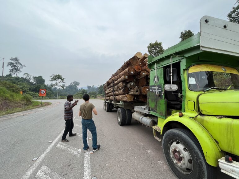
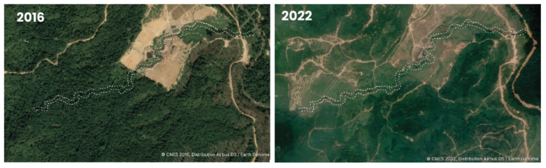
Low Choon Chyuan talks to a truck driver who transports logs from the project area. Image: Courtesy of Mukhriz Hazim
Lessons Learned
When investigating a highly regulated industry, it is important to understand the regulations and policy of the industry. Low studied the national certification MSPO and noted the key elements of it. This was very helpful to be able to assess any wrongdoings in the field.
In order to create an impactful investigation, journalists need direct and clear evidence. High-resolution satellite imagery from Earth Genome shows how the riparian area was cleared and its obvious impact.
When investigating deforestation issues, it is important to understand a company’s business model and how it is making money, either by researching the supply chain or by investigating the sources of its funds. After all, clearing a big parcel of land requires a lot of money. Investigating the source of funds is often the first step in uncovering governance and corruption issues.